
Germany's hottest streets 2026
Last time, the fleet data showed which city runs hottest. Now the same sensors ask the sharper question: which street?
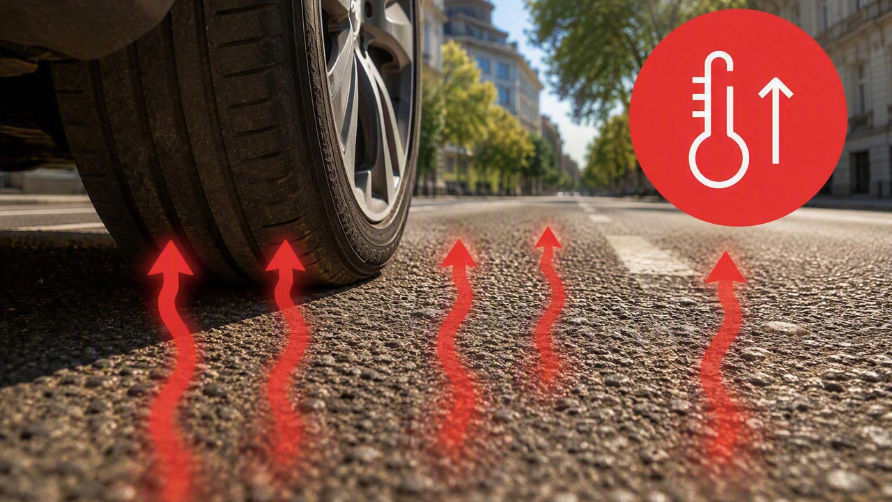
- Munich has the hottest street: Anonymized vehicle data from CARIAD, the Volkswagen Group's automotive software company, shows that Hildegardstraße in Munich will reach an average of 28.9 °C during the day in the summer of 2026, putting it at the top of the five largest German cities.
- Frankfurt's coolest streets are also relatively warm: Frankfurt's coolest street is still warmer than the hottest streets in Hamburg and only slightly below the hottest streets in Berlin.
- In Berlin, heat is mainly generated in the city center and on major traffic axes. The coolest streets are concentrated in green neighborhoods on the outskirts of the city
- In Cologne, the heat is distributed over several districts: Many streets outside the center are among the hottest.
- Hamburg remains cooler but shows local hotspots: Hamburg has the coolest streets. But here, too, there are significant temperature differences.
- Green, water and urban structure count: Wide traffic axes, tunnels, junctions and densely built-up squares are particularly common among the hot streets. Green residential areas, suburban locations and streets near forests, water or open landscapes remain cool.
The summer of 2026 shows that heat varies not only from city to city, but also from street to street. An analysis of anonymized vehicle data by us reveals which roads in Germany’s five largest cities turn into heat islands, where it stays comparatively cool, and where temperatures have climbed the most since 2022.
“Connected vehicles provide us with additional measuring points directly from real road traffic. This data is useful because heat is not evenly distributed across a city, even a few hundred meters can make a difference. Data from connected vehicles helps us to better recognize such small-scale patterns. This knowledge is an essential basis for advanced driver assistance systems of the future, which can make driving even safer and more comfortable," says Sebastian Franke, Product Owner Chassis & Road Conditions at CARIAD.
The runaway leader sits in Munich: Hildegardstraße in the old town averages 28.9 °C during the day in the summer of 2026 – and with +5.80 °C over 2022, it also posts the biggest jump of all. At the other end of the scale is Hamburg, where the HH-Neuallermöhe-West junction stays at just 18.9 °C.
Munich also opens up the widest gap: 8.1 °C separate its hottest and coolest streets. Across the cities, Hamburg stays the coolest on average, while Frankfurt am Main heats up the most.
One pattern runs through all five cities: wide traffic axes, tunnels, junctions and densely built-up squares show up strikingly often at the top of the heat lists. Where it stays cool, green residential districts, city edges, proximity to forests and open water and landscape areas dominate. But it is not only the district that is decisive: warm and cool streets can be close to each other. The immediate surroundings are what matter, especially shade, sealed surfaces, street width, traffic and air circulation.
The summer in Germany's five largest cities
Berlin
25.0 °C (Columbiadamm)
21.8 °C (Schlangenbader Straße)
+1.56 °C (Alemannenstraße)
Hamburg
23.8 °C (Elbtunnel)
18.9 °C (HH-Neuallermöhe-West junction)
+2.17 °C (Estedeich)
Munich
28.9 °C (Hildegardstraße)
20.8 °C (Joseph-Haas-Weg)
5.80 °C (Hildegardstraße)
Cologne
27.8 °C (Mengelbergstraße)
20.8 °C (Haferkamp)
+4.69 °C (Rennbahnstraße)
Frankfurt am Main
27.7 °C (Willmannstraße)
24.3 °C (Baumertstraße)
+2.74 °C (Wasgaustraße)
Berlin

Messedamm junction and Kaiserdamm are among the major traffic axes in the west of Berlin. Wittenbergplatz and Rosenthaler Platz, on the other hand, stand for densely built-up inner-city quarters with many sealed surfaces and little large-scale greenery directly on the street.
The coolest streets are quiet or suburban locations. Pölnitzweg and Hobrechtsfelder Chaussee are located in Buch and northern Pankow respectively. Pölnitzweg is close to Schlosspark Buch, the Panke river, ponds, meadows and neighbouring woodland.
Am Eichenhain, Sigismundkorso and Herthaplatz are in the very green district of Frohnau, with low-density development, large plots of land and old trees. Am Vierrutenberg is in Lübars, close to the open countryside and the Lübars lido. In Reinickendorf, the Rote Chaussee goes mainly through forest.
Schlangenbader Straße and Walter-Benjamin-Platz are exceptions closer to the city center. Schlangenbader Straße has an unusual built environment because it is covered by motorway structures. At Walter-Benjamin-Platz, building shadows or the water fountain may play a role.
Haberstraße in southern Neukölln is a short residential street near allotment gardens and less densely built-up areas but also close to the A113 motorway.
Bottom line: Berlin’s heat piles up along wide traffic axes, junctions and densely built-up squares – lots of asphalt, little shade. It stays cool in the green, low-density outer districts such as Buch and Frohnau, or on open, well-ventilated roads. Unlike in many major cities, proximity to water barely moves the needle here.
🟥 Top 10 hottest streets
- Columbiadamm · 25.0 °C
- Prühßstraße · 24.9 °C
- Flughafenstraße · 24.9 °C
- Messedamm junction · 24.9 °C
- Loewenhardtdamm · 24.8 °C
- Alt-Tempelhof · 24.6 °C
- Kaiserdamm · 24.6 °C
- Wittenbergplatz · 24.6 °C
- Seidelstraße junction · 24.5 °C
- Rosenthaler Platz · 24.5 °C
🟦 Top 10 coolest streets
- Schlangenbader Straße · 21.8 °C
- Pölnitzweg · 22.0 °C
- Rote Chaussee · 22.2 °C
- Walter-Benjamin-Platz · 22.3 °C
- Am Eichenhain · 22.3 °C
- Hobrechtsfelder Chaussee · 22.3 °C
- Sigismundkorso · 22.3 °C
- Herthaplatz · 22.4 °C
- Haberstraße · 22.4 °C
- Am Vierrutenberg · 22.5 °C
📈 Largest temperature increase since 2022
Alemannenstraße
+1.56 °C
Hamburg

Hamburg is the coolness champion of the field – on average, no other city stays cooler. And yet the data shows it: even in a city full of water, individual streets can heat up noticeably.
Hamburg's warm streets are strikingly often located along major traffic routes, crossings of the Elbe or roads on dykes. The Elbtunnel, the Norderelbbrücke and two junctions are heavily sealed infrastructure areas with a lot of asphalt and little shade. The Elbtunnel is part of the A7, one of Hamburg's most important traffic axes. Gauerter Hauptdeich, Estedeich and Ruschorter Hauptdeich are in areas close to water and landscape, but are often exposed to the sun. Proximity to water therefore does not automatically lead to low road temperatures. With Hartwicusstraße in Uhlenhorst and Löwenstraße in Hoheluft-Ost, densely built-up residential streets close to the city center also belong to the top group.
The coolest streets are mainly in open or less densely built-up areas. The Hindenburg Bridge and several residential streets can benefit from better ventilation and proximity to water, green or marsh areas.
The presence of junctions and motorway areas among the cooler readings may seem surprising. However, the Hamburg-Neuallermöhe-West junction is a section of the A25 in the south-east of the city, an open traffic area close to waterways and marshland.
Hamburg’s heat map ticks differently from Munich’s or Cologne’s: the hottest streets are rarely classic residential streets, but crossings, connections and traffic areas on the water or near the harbor. The absolute values stay lower than in the south. So Hamburg benefits from its location and its water, yet stubborn hotspots still form along the big transport and port arteries.
🟥 Top 10 hottest streets
- Elbtunnel Hamburg · 23.8 °C
- HH-Allermöhe junction · 23.8 °C
- Hartwicusstraße · 23.7 °C
- Hamburg-Bahrenfeld junction · 23.2 °C
- Gauerter Hauptdeich · 23.1 °C
- Löwenstraße · 23.1 °C
- Estedeich · 23.0 °C
- Norderelbbrücke · 23.0 °C
- Ruschorter Hauptdeich · 23.0 °C
- Leeswig · 22.9 °C
🟦 Top 10 coolest streets
- HH-Neuallermöhe-West junction · 18.9 °C
- Hindenburg Bridge · 19.4 °C
- Fritz-Reuter-Straße · 19.5 °C
- Anderheitsallee · 19.7 °C
- Beiersdorfstraße · 19.8 °C
- District Road 85 · 19.9 °C
- Grot Sahl · 20.1 °C
- In the field · 20.2 °C
- Lerchenberg · 20.2 °C
- Musäusstraße · 20.2 °C
📈 Largest increase since 2022
Estedeich · +2.17 °C
Munich

Munich delivers the widest range in the field and the starkest contrast. Its hottest street, Hildegardstraße, sits right in the old town between Neuturmstraße and Thomas-Wimmer-Ring: dense, central, historically built, with barely any greenery around the Altstadtring.
Ledererstraße follows the same pattern: It is also located in the old town and runs near Marienplatz and the valley. The street is short, central and historic.
At the same time, Munich's top 10 also include streets much farther from the center. Seldeneckstraße (Aubing), Am Ährenfeld (Hadern), Bingener Straße (Moosach) as well as Reschreiterstraße, Franz-Fackler-Straße, Stanigplatz and Ebereschenstraße (all four in Feldmoching-Hasenbergl) are located in western or northern residential areas. Direct sunlight, a lack of mature trees and larger asphalted areas may be decisive there. The Effner tunnel, as a heavily sealed traffic area, also heats up more than average.
In the coolest streets of the city, the influence of greener and less dense locations is recognizable. Joseph-Haas-Weg is located in Pasing in a residential area outside the dense city center. Am Perlacher Forst borders on a large forest and green space. Meichelbeckstraße, Schloßstraße, Vinzenz-Schüpfer-Straße, Friedastraße and Alpenveilchenstraße are in quieter, green residential areas. Bridges, such as the Herzog-Heinrich-Brücke, can benefit from the proximity to the water and are also better ventilated.
Nowhere else do two worlds collide this clearly: hot, densely developed old-town and transport spaces on one side, cool streets close to woodland and in low-density residential areas on the other.
🟥 Top 10 hottest streets
- Hildegardstraße · 28.9 °C
- Seldeneckstraße · 26.4 °C
- Am Ährenfeld · 26.1 °C
- Reschreiterstraße · 26.0 °C
- Bingener Straße · 26.0 °C
- Franz-Fackler-Straße · 25.9 °C
- Ledererstraße · 25.9 °C
- Stanigplatz · 25.9 °C
- Ebereschenstraße · 25.8 °C
- Effner Tunnel · 25.8 °C
🟦 Top 10 coolest streets
- Joseph-Haas-Weg · 20.8 °C
- Am Perlacher Forst · 22.1 °C
- Herzog-Heinrich-Brücke · 22.2 °C
- Meichelbeckstraße · 22.6 °C
- Schloßstraße · 22.6 °C
- Vinzenz-Schüpfer-Straße · 22.6 °C
- Johannisplatz · 22.7 °C
- Friedastraße · 22.8 °C
- Kirchenstraße · 22.8 °C
- Alpenveilchenstraße · 22.8 °C
📈 Largest increase since 2022
Hildegardstraße · +5.80 °C
Cologne

Cologne holds an unenviable record: no other city has warmed up more on average since 2022. And the heat doesn’t stay downtown, but it spreads more widely across the districts than anywhere else.
Mengelbergstraße is located in Altstadt-Süd in the Pantaleonsviertel and is an asphalted inner-city street. Trimbornstraße is in Kalk on the right bank of the Rhine, which is characterized by dense development, railway and traffic areas. Krefelder Wall, Lenauplatz and Felix-Rexhausen-Platz also stand for urban districts with a comparatively large amount of sealed space. Deliastraße, on the other hand, is located in the northern district of Volkhoven/Weiler.
Weilerstraße, Blockstraße, Leopold-Gmelin-Straße and Nesselrodestraße also show that Cologne's warm streets are not exclusively in the center.
Cologne doesn’t have the one inner-city hotspot, but several warm zones on both banks of the Rhine. The curious part: not a single one of the top 10 sits directly beside the river.
The coolest streets are often beyond the densely built-up city center or in districts with green and open spaces. Haferkamp and the Morgengraben are located in the north of Cologne on the right bank of the Rhine, close to each other in Stammheim. Reiherweg, Kannebäckerstraße and Langenackerstraße are also quieter residential or suburban locations with gardens and open spaces. Theklastraße and Nettesheimer Straße are likewiese outside the high-density city center.
Overall, only a small number of streets were cooler than in 2022, indicating a broad rise in temperatures across the city.
🟥 Top 10 hottest streets
- Mengelbergstraße · 27.8 °C
- Weilerstraße · 27.0 °C
- Blockstraße · 26.9 °C
- Trimbornstraße · 26.7 °C
- Krefelder Wall · 26.6 °C
- Deliastraße · 26.6 °C
- Lenauplatz · 26.6 °C
- Felix-Rexhausen-Platz · 26.4 °C
- Leopold-Gmelin-Straße · 26.3 °C
- Nesselrodestraße · 26.2 °C
🟦 Top 10 coolest streets
- Haferkamp · 20.8 °C
- Morgengraben · 22.5 °C
- Reiherweg · 22.6 °C
- Kannebäckerstraße · 22.8 °C
- Langenackerstraße · 23.2 °C
- Mauenheimer Straße · 23.3 °C
- Theklastraße · 23.5 °C
- Charlottenstraße · 23.7 °C
- In der Hell · 23.7 °C
- Nettesheimer Straße · 23.7 °C
📈 Largest increase since 2022
Rennbahnstraße · +4.69 °C
Deliastraße · +4.69 °C
Frankfurt am Main

Frankfurt’s hottest streets sort into three groups. Willmannstraße, Eifelstraße and Wasgaustraße are residential and connecting streets in the outer districts. The Zeppelinheim junction and the Theatertunnel stand for large-scale sealed traffic areas. Theatertunnel Theatertunnel, for example, links the old town and the main station district beneath Willy-Brandt-Platz.
Dreieichstraße and Frankensteiner Platz are in densely built-up Sachsenhausen, while Elektronstraße and Alte Falterstraße are more strongly characterised by commercial or mixed-use development. Heddernheimer Landstraße runs between Heddernheim and Niederursel and crosses the Nidda. Its high value shows that proximity to water does not automatically cool a heavily sealed section of road.
The coolest streets also show a mixed picture. Mainka is high on the list and lies directly beside the river. Alt-Erlenbach also fits into this picture as a greener location on the outskirts of the city. Baumertstraße, Kleestraße and Schießhüttenstraße are in Fechenheim, as is the warmest street, Willmannstraße. This shows that even within a quarter there are large differences.
At Am Schwalbenschwanz (Eschersheim, Dornbusch and Ginnheim), Kahnplatz (Nied), Jungmannstraße (Griesheim, near the Main), greenery, open spaces or proximity to water fit well with the low values. Although Oeder Weg is centrally located in Nordend, it is close to Holzhausenpark and it has been traffic-calmed. Stoltzestraße, on the other hand, is in the heart of the city center.
What stands out in Frankfurt: high readings turn up in residential districts just as much as at tunnels, junctions and commercial sites. The common denominator isn’t the district, but the specific street environment – extensive asphalt, little shade, heavy traffic.
🟥 Top 10 hottest streets
- Willmannstraße · 27.7 °C
- Eifelstraße · 27.6 °C
- Wasgaustraße · 27.5 °C
- Zeppelinheim junction · 27.3 °C
- Heddernheimer Landstraße · 27.3 °C
- Theatertunnel · 27.3 °C
- Dreieichstraße · 27.3 °C
- Frankensteiner Platz · 27.3 °C
- Elektronstraße · 27.2 °C
- Alte Falterstraße · 27.2 °C
🟦 Top 10 coolest streets
- Baumertstraße · 24.3 °C
- Kleestraße · 24.5 °C
- Am Schwalbenschwanz · 24.6 °C
- Mainkai · 24.6 °C
- Alt-Erlenbach · 24.6 °C
- Kahnplatz · 24.7 °C
- Oeder Weg · 24.7 °C
- Jungmannstraße · 24.8 °C
- Stoltzestraße · 24.8 °C
- Schießhüttenstraße · 24.9 °C
📈 Largest increase since 2022
Wasgaustraße · +2.74 °C
About the database and the analysis
The analysis covers streets in Germany's five largest cities: Berlin, Hamburg, Cologne, Munich and Frankfurt am Main. It is based on anonymized, summer air temperatures measured around vehicles, for June and July of each year, during the day from 8 a.m. to 8 p.m. For better analysis, long roads are divided into several measurement sections. The analysis includes streets with an average of at least 10 data points per 25-meter section in June and July of a given year. The temperature change is the difference between the average summer daytime temperature in 2026 and the corresponding figure for 2022. The descriptions of the streets' locations provide possible explanations, but the vehicle data alone does not allow definitive conclusions about the causes of temperatures on individual streets.
*AI Generated Header Image


-
DECODED: What is driving dynamics?
 The three kinds of motion behind every drive, and the software that keeps them in sync.22/09/2026
 -
DECODED: Why do modern cars need so many different sensors?
 No single sensor sees it all. Discover why automated driving relies on multiple perspectives.09/09/2026
 -
Germany's heat map: What are the hottest cities in the summer of 2026?
 Connected vehicle data reveals local heat distribution across Germany. Freiburg leads while the Rhine-Ruhr region warms fastest.26/08/2026