03/12/2024
 - 4 min

How swarm data is paving the way for automated driving & road safety

Powerful real-time swarm data on road conditions supports Level 3 automated driving and improves safety for everyone.

  • Technology
US map with spot lights

In automated driving, knowing the road conditions ahead is crucial. Real-time data on road friction and roughness helps to correctly calculate the actual braking distance at any point during the journey. In addition, this data also makes services such as Local Hazard Information (LHI) more accurate. Thanks to its large size, the Volkswagen Group’s car fleet is perfectly suited for collecting road conditions data, providing both high quality and quantity.

Swarm data for real-time safety

Connected Friction, a project by CARIAD and its Swedish subsidiary NIRA, collects real-time data on road slipperiness, roughness, and weather conditions across Europe and North America. This project allows vehicles to share critical safety data with each other, benefiting not just individual drivers but entire road systems. “The Connected Friction project is a result of extensive teamwork across Volkswagen Group brands and departments,” explained Sebastian Franke, product owner at CARIAD. 

h

We have made use of our collective expertise and resources to seamlessly integrate this technology into our customer fleet, to enhance both safety and the driving experience.

g
Sebastian Franke / Product Owner at CARIAD
Sebastian Franke

Sebastian Franke

Product Owner at CARIAD

The project started in 2020 and quickly expanded to soon cover over two million vehicles. The data collected plays an integral part for Level 3 automated driving, where a car can drive mainly by itself with the driver only having to take over when asked to by the system. “No sensor can predict road conditions kilometers ahead, but a network of connected cars can,” Franke added.

Protecting user privacy

Protecting the privacy of its customers is a priority for the Volkswagen Group. The data is therefore anonymized and aggregated, with no link to individual cars or drivers. This involves stripping any personal identifiers from the data before it is analyzed. Drivers can also opt out of data collection entirely if they choose to.

Higher customer safety – also for cars built years ago

Even Volkswagen Group cars built long before 2020 benefit from the data as it improves the Local Hazard Information (LHI) service. That’s the message your car displays to warn you about nearby dangers, like accidents or bad weather. “Our customers get real-time safety information that helps them make smarter driving decisions,” said Marc-René Kiene, Technical Project Leader LHI at Volkswagen. “Whether they are driving in icy conditions or on rough terrain, the Connected Friction Project adds an extra layer of safety.”

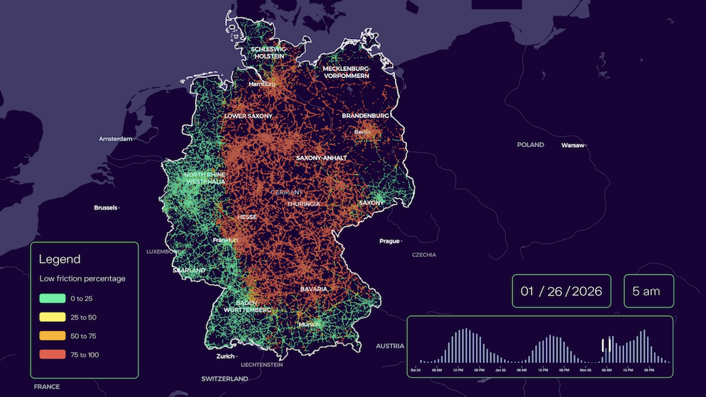
Germany map Example Germany: state-of-the-art LHI (red) versus significantly expanded coverage with Connected Friction data (blue)

Better road clearance for everyone

That's not all: The Connected Friction project also shares anonymized data with road network operators and road maintenance authorities, which helps them to plan road clearance in winter and monitor the health of their roads. Scandinavian countries spend around €520 million annually on winter maintenance (1). So it is no surprise Fredrik Lindström, national coordinator for road surface measurements at Trafikverket, the Swedish Transport Administration, appreciated the project: "With the collection of anonymized vehicle data from connected vehicles, we should be able to achieve better decision-making and thus better road maintenance." 

The Connected Friction Project is just at the beginning. It is set to expand to more Volkswagen brands, and so, more drivers will profit from enhanced safety and advanced automated driving technologies.

Looking ahead: More applications that can benefit from real-time road surface condition data

More accurate electric vehicle range prediction

Road roughness, wetness, or ice significantly impacts how much energy an electric vehicle (EV) consumes. Using real-time data to factor in these road conditions, EV range predictions could become much more accurate, which helps drivers to plan charging stops more effectively.

Automated driving

In automated driving systems, knowing the road surface conditions is essential for decision-making. The Group Grip Map anonymized data can help vehicles adapt to varying road conditions, such as icy patches or slippery surfaces. Systems like adaptive cruise control, lane-keeping assist, and emergency braking can adjust their responses based on the actual road conditions, improving both safety and comfort.

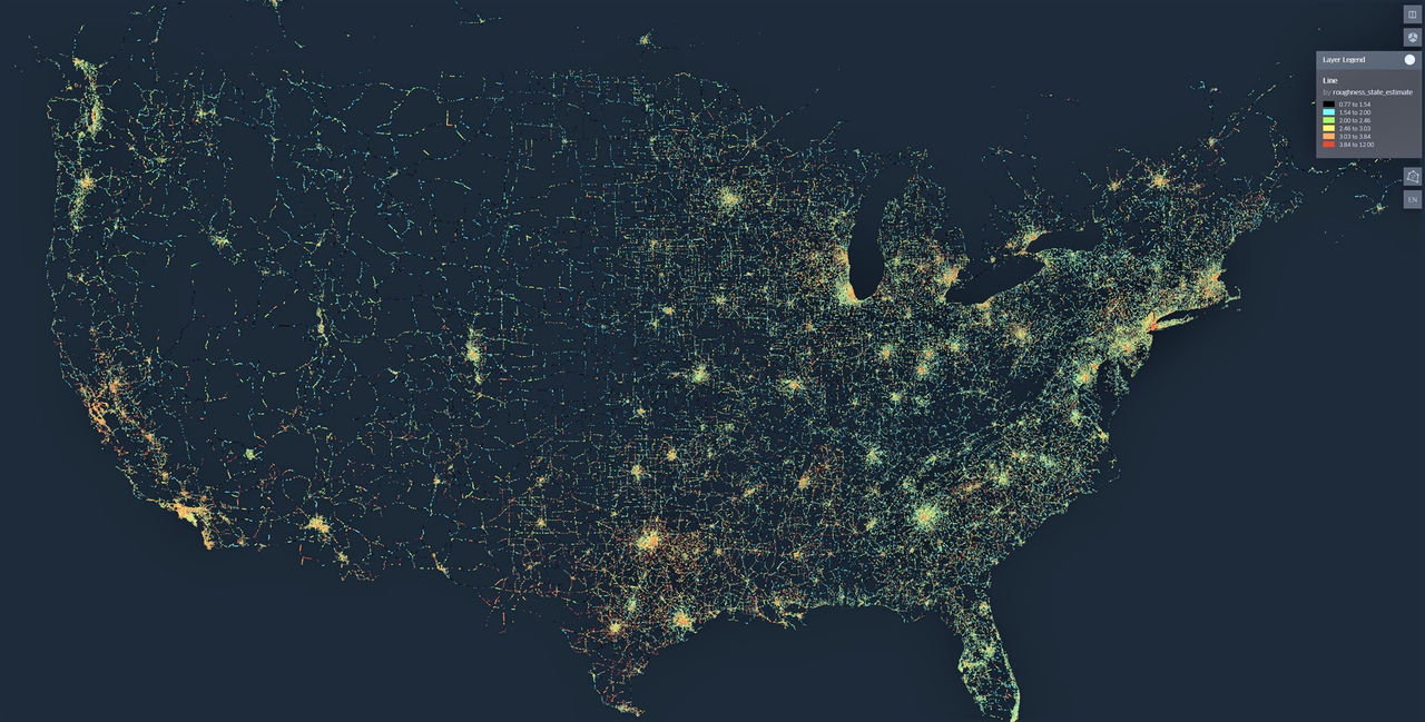
(1) Calculation based on: Vinterväghållning i de nordiska länderna, Statusrapport 2022, page 41. Local currencies converted to EUR. 

CARIAD Media Team

CARIAD Media Team